Conservation laws are key principles in physics that ensure certain quantities r...

The discovery of antiparticles revolutionized physics by revealing that every pa...
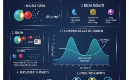
Mass distribution of fission products explains how the fragments formed during n...
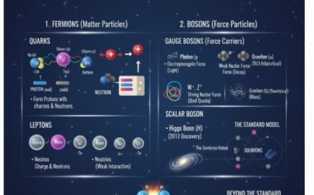
Elementary particles are the fundamental building blocks of the universe. They i...
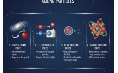
Fundamental interactions are the basic forces that control how particles and mat...
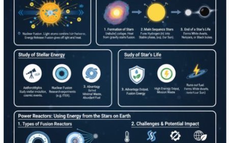
Stellar energy is the power produced by stars through nuclear fusion, the proces...
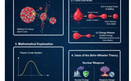
The Bohr-Wheeler theory of nuclear fission explains how and why heavy atomic nuc...

Particle accelerators are machines that use electromagnetic fields to speed up c...
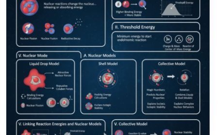
Understand how nuclear reactions release or absorb energy through fission, fusio...
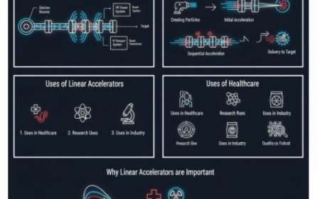
A linear accelerator (linac) is a powerful machine that accelerates charged part...
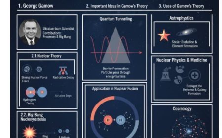
Explore George Gamow’s groundbreaking theory in nuclear physics — from alpha dec...
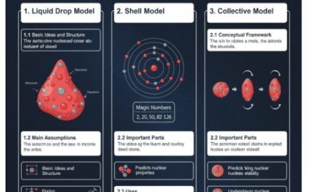
The Liquid Drop Model, Shell Model, and Collective Model are three key framework...
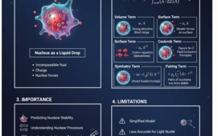
The Semi-Empirical Mass Formula (SEMF) is a key concept in nuclear physics that ...
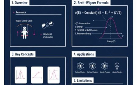
The Breit-Wigner formula explains how resonance affects particle interactions in...
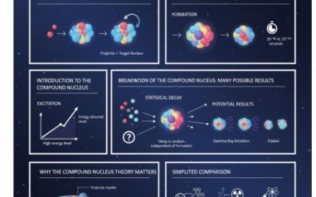
Learn how a compound nucleus forms during nuclear reactions when a projectile an...