REMOTE SENSING APPLICATIONS IN LANDSLIDES, FLOODS, AND SOIL EROSION
Understand the applications of remote sensing in monitoring landslides, floods, and soil erosion, including image analysis and change detection.
Remote Sensing Applications in Landslides, Floods, and Soil Erosion
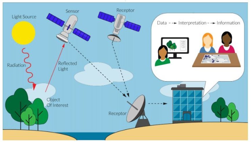
- Remote sensing is a very important part of how we understand and deal with natural disasters like storms, earthquakes, and soil erosion.
- Because it can collect data from far away, it is a very useful tool for keeping an eye on these things over large areas and at very high frequencies.
IMAGE SOURCE
1. Landslides
a) Detection and Mapping
- Landsat, Sentinel-2, and other multispectral satellites take pictures that show changes in the amount of plant cover, the amount of water in the soil, and the shape of the ground's surface that could be caused by landslides.
- SAR (Synthetic Aperture Radar): SAR systems like Sentinel-1 can see through clouds and plants, so they can find landslides in all kinds of weather.
- Interferometric SAR (InSAR) can find ground movement to within a millimeter, showing places where floods are likely to happen.
- Aerial Photogrammetry: High-resolution aerial photos give detailed information about the land's surface and make it possible to make 3D models for studying landslides.
b) Risk Assessment and Monitoring
Using remote sensing data to make elevation models and study the slope and direction of land can help find places that are likely to slide during a landslide.
Monitoring Rainfall and Soil Moisture: Data on rainfall from weather satellites and data on soil moisture from microwave devices can be put together to figure out how likely it is that a landslide will happen.
Time-series analysis: Using InSAR or optical images to track changes in how the surface deforms over time can help find landslides before they happen.
2. Floods
a) Flood Area Mapping
Optical images: Multispectral imagery makes it easy to see bodies of water that are changing quickly, which lets you map out the length of a flood and figure out how much damage it did.
If you use SAR images, you can map floods even when it is raining or snowing because it can see through clouds.
Radar Altimetry: Radar altimeters on satellites measure the height of water in rivers and other areas of water, which is useful for predicting floods.
b) Flood Risk Assessment
Utilizing remote sensing data in hydrological models allows us to practice floods and figure out the risk of flooding in various areas.
Urban Flood Modeling: By mapping impermeable surfaces, drainage systems, and slope data, satellite data can find urban places that are likely to flood.
3. Soil Erosion
a) Erosion Mapping and Assessment
- Changes in the amount of plants, the color of the soil, and the roughness of the surface can all be signs of soil erosion.
- LiDAR stands for "Light Detection and Ranging." LiDAR data shows the exact geography of the surface and points out places where erosion and sedimentation have happened.
- Tracking changes in the amount of plants, the qualities of the soil, and the features of the ground's surface over time shows how erosion works.
b) Erosion Modeling and Mitigation
Digital Elevation Models (DEMs): DEMs made from remote sensing data can be used to model how water flows and how silt moves, which helps figure out which areas are likely to erode.
Land Cover Classification: Remote sensing data helps figure out the different types of land cover, which lets protection efforts be more focused.
Advice on how to manage land: Analyses of soil erosion trends using remote sensing can help with land management tasks such as replanting, terracing, and sustainable farming.
What's Your Reaction?


