DISASTER SOURCES IN ENVIRONMENTAL GEOLOGY
Explore the various sources of disasters in environmental geology, including earthquakes, landslides, floods, and volcanic eruptions.
0
94
An Introductory Examination of Disaster Sources in Environmental Geology
- The field of environmental geology examines the reciprocal relationship between geological processes and the environment, as well as the effects of human activities on the geological systems of the Earth.
- Hazards in environmental geology can cause catastrophic consequences for communities, ecology, and the economy.
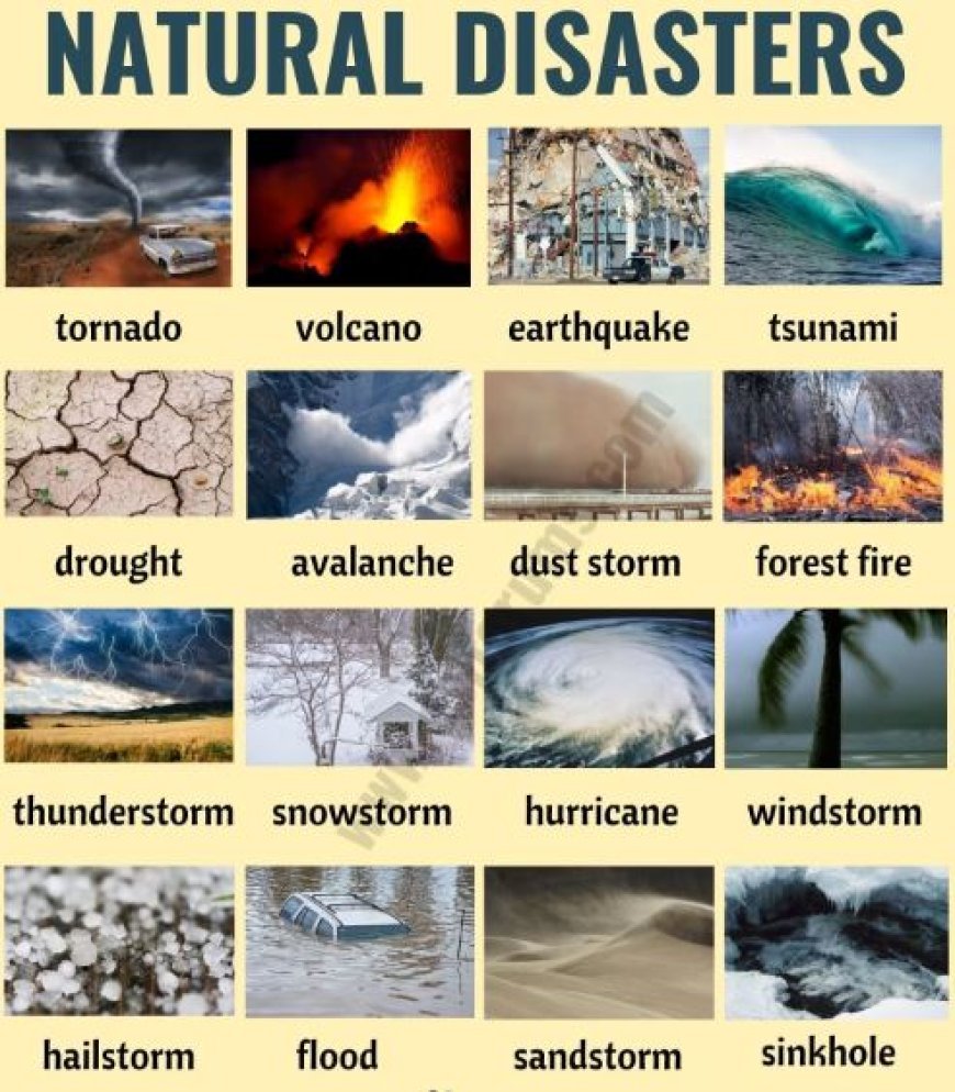
- Natural Disasters
- Natural catastrophes are geological phenomena resulting from inherent processes of the Earth. Severe events can occur abruptly and can lead to substantial destruction and loss of life.
Below are a few of the main categories:
- Earthquakes are abrupt shakings of the Earth's surface resulting from the dynamic motion of tectonic plates.
- Origin: They often arise along fault lines when tectonic plates undergo internal grinding.
Impact: May result in structural failures, seismic surges, and avalanches. - Volcanoes are porous structures in the Earth's surface that facilitate the escape of magma, ash, and gases.
- Origin: They arise when subterranean magma compels itself to ascend to the Earth's surface.
- Impact: Eruptions have the potential to devastate scenic areas, influence air quality, and disrupt climate.
- In geology, landslides refer to the downward movement of rock and soil along a slope.
- Caused by variables such as intense precipitation, seismic events, or anthropogenic actions (e.g., mining).
- Effects: Can submerge villages, obstruct waterways, and impair infrastructure.
d. Floods
Definition: The incursion of water onto typically dry terrain.
Origin: Arising from severe precipitation, snow melting, or dam collapses.
Impact: This phenomenon can cause soil erosion, water source contamination, and population displacement.
- Human-Induced Disasters
- The environment is enormously influenced by human activities, which can occasionally result in geological catastrophes. Shown here are several illustrations:
Mineral extraction operations
- Extraction refers to the process of obtaining minerals and other geological substances.
- Origin: Technologies such as strip mining and deep mining have the potential to disrupt the stability of the ground.
- Effect: May result in the formation of sinkholes, erosion of soil, and pollution of nearby water sources.
- Urbanization refers to the process by which cities and towns expand and result in alterations in land usage.
- Origin: Construction expands impermeable surfaces, resulting in increased runoff.
- The impact of this phenomenon includes the potential for floods, heightened danger of landslides, and burden on natural water systems.
- Deforestation is the extensive removal of trees from forests.
- Source: Frequently conducted for agricultural, logging, or urban development purposes.
- Impact: Results in soil erosion, habitat loss, and heightened flood hazards caused by reduced water absorption.
- Climatology is the study of long-term variations in temperature and weather patterns.
- Origin: Primarily attributed to the release of greenhouse gases resulting from human activity.
- The impact of climate change is the exacerbation of extreme weather phenomena such as hurricanes, increasing sea levels, and droughts.
3. Integrated Approach to Disaster Management
- Efficient management and mitigation of geological catastrophes need a comprehensive understanding of their origins.
Consider the following strategies to tackle these problems:
a. Risk Assessment
- Identifying disaster-prone locations.
- Conducting an evaluation of possible effects on communities and the environment.
b.Sustainable Practices
- Promoting conscientious implementation of land use and resource management.
- Promoting reforestation and sustainable agriculture as means to mitigate erosion.
C. Readiness of the Community
- Disseminating knowledge to communities on disaster hazards and emergency protocols.
- Creating contingency plans and strategic evacuation pathways.
d. Scientific Technology
- Employing advanced technologies such as Geographic Information Systems (GIS) and remote sensing to observe and analyze geological changes.
- Deploying preemptive alert systems for occurrences such as seismic activities and excessive precipitation.