INTERPRETATION STRATEGIES AND KEYS IN REMOTE SENSING
Discover the interpretation strategies and keys used in remote sensing, including visual and digital methods, and their applications.
Interpretation Strategies and Keys in Remote Sensing
- Remote sensing is an essential technique used for many purposes such as environmental monitoring, agriculture, urban planning, and disaster management.
- Remote data collection and analysis offer crucial observations on the Earth's surface and atmosphere.
- Efficient analysis of remote sensing data necessitates a methodical approach and comprehension of many methodologies and instruments.
Here is an in-depth analysis of these methods and approaches.
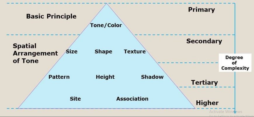
Fundamental Interpretation Strategies
Visual analysis
Visual analysis is a fundamental method in remote sensing that relies on the human capacity to identify features based on visual attributes.
Crucial Elements Encompass
- Color Differentiation: Different types of land coverings exhibit varying light reflection properties, which may be observed by using color composites like false-color pictures.
- This strategy is crucial in discerning between several categories of land cover, such as separating plants from bodies of water.
- Texture evaluation: The examination of surface texture, which indicates the degree of roughness or smoothness, can offer valuable information about various land applications.
- For example, the tactile quality of thick woods may be compared to that of metropolitan areas or bodies of water, which helps in examining land-use patterns.
Methods for processing digital images
- The progress in technology has greatly improved the functionalities of digital image processing in remote sensing. Some important approaches include:
- Image enhancement involves the application of techniques like histogram equalization to enhance the contrast of pictures, hence making features more conspicuous and facilitating their analysis.
- Spatial filtering is a technique used to decrease noise and improve the identification of characteristics, guaranteeing that interpretations are derived from data of superior quality.
Classification Methods
Categorization is crucial for arranging data into distinct groups that reflect various forms of land use or land cover.
Crucial techniques comprise
- Supervised classification is a technique that entails training algorithms using predetermined samples of different land cover classes.
- Analysts choose representative samples, and the computer then categorizes the remaining data using these exemplars.
- Unsupervised classification employs algorithms to cluster pixels according to inherent data patterns, without any prior knowledge of land cover categories.
- Methods like K-means clustering are used to detect and categorize pixels that are similar to each other.
Change Detection Techniques
Continuous monitoring of changes throughout time is essential for efficient resource management and environmental surveillance.
Typical methods comprise
- Post-Classification Comparison refers to the process of categorizing pictures from distinct time periods and analyzing the classifications to detect alterations in land cover.
- Differencing is a method that involves subtracting imagery captured at separate periods in order to emphasize and bring attention to any changes that have occurred.
- It is highly efficient in identifying patterns such as urban growth or deforestation.
Essential Tools and Strategies for Exact Interpretation
Remote sensing interpretation is enhanced by utilizing several instruments and approaches to guarantee precision and thoroughness of analysis:
Spectral Signature Libraries
- Every substance has a distinct way of reflecting light at various wavelengths, resulting in a distinctive spectral signature.
- The utilization of spectral signature libraries improves the capacity to precisely identify and categorize land cover types by analyzing their reflectance patterns.
Field Validation
- Ground truthing, also known as field validation, is crucial for confirming the precision of remote sensing interpretations.
- Analysts can enhance accuracy by conducting field surveys to validate classifications and refine their interpretations.
Integration of Geographic Information System (GIS)
- The integration of remote sensing data with Geographic Information Systems (GIS) offers a comprehensive framework for spatial analysis.
- GIS technologies facilitate the superimposition and examination of numerous datasets, providing more profound understanding of spatial connections and augmenting the overall precision of interpretations.