UTILIZING REMOTE SENSING IN GEOMORPHOLOGICAL RESEARCH
Discover the applications of remote sensing in geomorphological studies, including landform analysis and terrain mapping.
Utilizing Remote Sen sing in Geomorphological Research
- Geomorphology, the study of landforms and the processes that shape them, relies significantly on developments in technology to assist data gathering, processing, and interpretation.
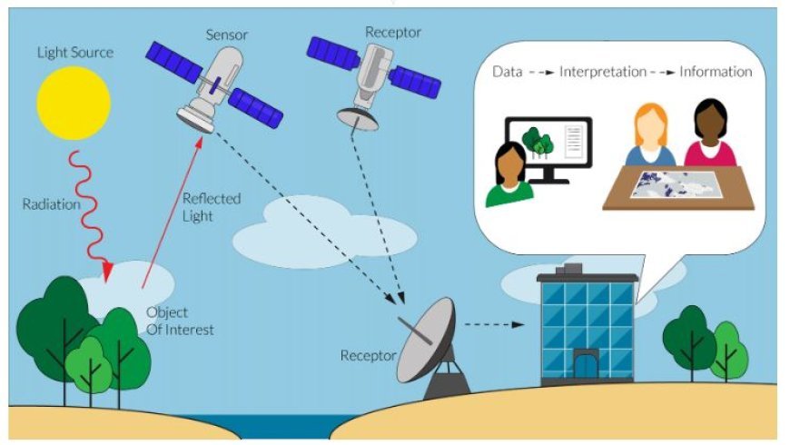
- Geomorphological studies can not be done without remote sensing, which is the process of getting information about a place from afar, usually by using satellites or planes.
Remote Sensing in Geomorphology
- Through the unique perspective that remote sensing offers on geographical elements, researchers can effectively gather massive amounts of data over large areas.
- Remote sensing data can provide crucial insights into the dynamics of landscapes, the evolution of landforms, and processes that occur on the earth's surface.
Principal Uses of Remote Sensing for Geomorphological Research
- Landform Classification and Mapping
- The classification of different landforms, including hills, valleys, rivers, and deserts, is made easier by remote sensing techniques.
- With the use of advanced photography, geomorphologists may produce intricate maps of landforms by distinguishing between different geological materials based on their spectral fingerprints.
- Spectral Analysis: By employing multispectral imagery, researchers may identify landforms based on vegetation cover, soil characteristics, and moisture levels.
- 3D Modeling: LiDAR data provides accurate terrain modeling in three dimensions, facilitating the visualization and comprehension of intricate geomorphic features.
- Monitoring Erosion and Sedimentation
- Erosion and sedimentation processes greatly effect landscape evolution. Remote sensing enables for regular monitoring of these processes, providing essential data for managing natural resources.
- Change Detection: Time-series satellite pictures can be processed to detect changes in landforms owing to erosion or sediment deposition, revealing information into the effectiveness of land management strategies.
- Quantitative Assessment: To measure the rates of erosion and sediment transport in various environments, surface change metrics can be obtained from multi-temporal datasets.
- Analyzing Natural Hazards
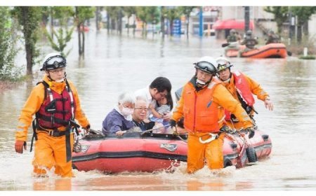
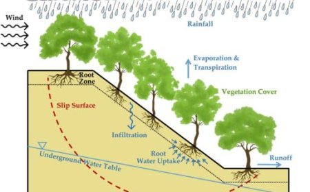
- Geomorphological research is frequently used to better understand and mitigate natural disasters such as landslides, floods, and earthquakes.
- Hazard Assessment: By examining topography and land use patterns, remote sensing assists in locating areas that are susceptible to disasters. This information is crucial for developing preparedness and response plans.
- Post-Disaster Analysis: Remote sensing can help with quick damage assessments following disasters, which can aid with resource allocation and recovery planning.
- Landscape Evolution Studies
- The study of landscape evolution over long timescales is made possible by remote sensing, which provides insights into processes including tectonics, glaciers, and human influences.
- Paleogeography Reconstruction: By using historical remote sensing data, one can better understand earth surface processes over geological timescales by reconstructing past landscapes.
- Effects of Climate Change: Remote sensing analysis of changes in vegetation and landform patterns can shed light on how climate change is affecting geomorphological features.
Challenges and Limitations
Although remote sensing has many benefits, there are a number of obstacles to overcome:
- Data Resolution: Small-scale geomorphological characteristics may occasionally be missed by satellite pictures' limited spatial resolution.
- Atmospheric Interference: The quality and precision of remote sensing data can be impacted by meteorological circumstances, requiring remedial actions to be taken during data collection and processing.
- Technical Expertise: Analyzing remote sensing data takes specific knowledge and abilities, posing a barrier for some researchers.
What's Your Reaction?


