GEOMORPHOLOGY AND MILITARY GEOLOGY
Geomorphology guides military strategy with terrain analysis. Military Geology unlocks resources for operations.
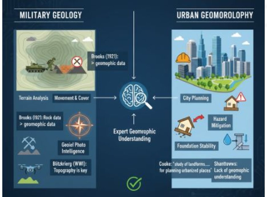
Geomorphology and Military Geology
- Thornbury talks about how geomorphology is important in wartime.
- Compared to geomorphic data, rock data was more useful (Brooks, 1921). Stable ditches were the sites of the majority of combat during World War I.
- The most useful information was about the types of rocks that would be found in ditches, mines, and countermines, as well as about water sources and other geological materials that might be available.
- It is true that terrain helped the Allies move and plan their attack lines, but it is not fair to say that they used basic geomorphic understanding very much.
- As the blitzkrieg style of fighting grew in popularity during World War II, topography became more significant. This is because the success of a blitz depends a lot on how easy it is to move through the land.
- Because of this, the military has used the words "terrain awareness" and "terrain analysis" a lot more these days.
- It's possible that a geomorphologist doesn't know how to best use terrains for military activities, but his ideas about how terrains work are much better than those of others, including military specialists. He understands that landforms are the result of geomorphic and geologic processes interacting over time.
- Landforms are not just a bunch of random shapes; they have ordered relationships that show where they came from and reveal a lot about the geology and structure of the bedrock below, as well as the soils and plants that grow in a certain area.
- It was Erdmann (1943) who said that a geomorphologist has "an eye for the ground or an instinctive eye for configuration, the judgement of how far ground, seen or unseen, is likely to lie when you get to it...
- Geophysics and war are both based on the ground. Being able to read both topographic maps and overhead photos and having a general knowledge of the different types of terrain is important for planning military battles.
- Hunt (1950) said this about using aerial photos in this way: "Even where geologic maps are missing or are so small-scale that they are practically useless for tactical intelligence, geologic principles can be used to interpret the terrain from aerial photographs.
- If you can read vertical pictures, you can tell the difference between mountains, hills, lakes, rivers, trees, fields, and some kinds of swamps.
- In order to obtain comprehensive landscape intelligence, however, the images can and should be used to determine much more.
- To figure out the geography, it's important to know what kind of hill, plain, river, lake, etc. there is. With some confidence, the interpreter can then make guesses about the water supply, the type and depth of the soil, how easy it is to travel on, problems with ground drainage and other building issues, building materials, movement and cover, and many other factors that are necessary to get a good picture of the terrain.
- To sum up, overhead photos are helpful for creating landscape intelligence because they show the geology of the area.
- Just recognising a hill or other landform in a picture isn't enough to tell the whole story. What's really important is understanding what the landform means in terms of the type of ground and slope.
Geography and Building Cities
- Using geomorphological information to help build cities has become so important that it has grown into its own field, called urban geomorphology. R.U. says that this area of geomorphology is "the study of landforms and their related processes, materials, and hazards in ways that are useful for planning, developing, and managing urbanised places where urban growth is predicted." Make food.
- The stability, safety, basic needs, and later growth of a city or town rely on geomorphological features such as lithological and topographical features, water conditions, and geomorphic features. An urban geomorphologist's job starts long before cities are built.
- They do things like field surveys, landscape classification, identification, and choosing other places for people to live. The job of an urban geomorphologist is to study how natural events affect people living in cities and how cities change the environment, both during and after they are built.
- R.U. Cooke brought it up, saying, "Many geomorphological problems that planners and engineers haven't fully understood until now destroy and damage urban settlements in a wide range of environmental settings.
- For example, foundation materials drop in periglacial and dry lands in oil-rich states; weathering breaks down foundations; roads get damaged; flooding in humid subtropical regions damages buildings, and so on.
- Bad management or ignorance of the land's shape are contributing factors to all of these and many other issues. Not much thought goes into knowing the geomorphological conditions that existed before cities were built, especially in poor countries.
- Because of this, growth gets out of hand, which leads to illegal villages or shantytowns. It often leads to major problems in society and the world.
What's Your Reaction?


