CONCEPTS OF GEOMORPHOLOGY
Geomorphology explores how wind, water, and ice shape and reshape the planet.
"Geomorphology" comes from the Greek words "geo," "morpho," and "logos," which all mean "earth," "forms," and "study." So, geomorphology means "the study of the shapes of the earth." The main thing that geomorphologists study is the earth's surface information, such as where it came from, how it changed over time, and how it affects human behavior. These are the main ideas or basic concepts, of geomorphology:
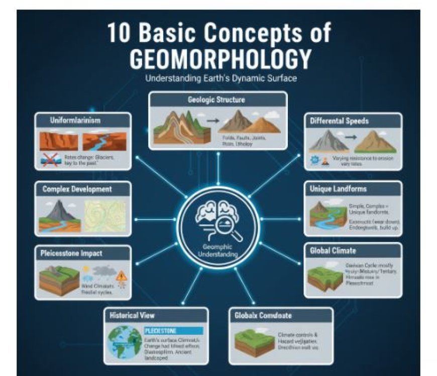
1. Throughout natural time, the same physical rules and processes have been at work, though not always as strongly as they are now. This is the most important idea in geology, and it's called the concept of uniformitarianism. Hutton first said it in the year 1785. According to Hutton, "the present is the key to the past.". He said that geologic processes have been going on for as long as geologic time has been recorded. It's not true; we know that. During the Pleistocene and other natural times, glaciers were much more important than they are now. Climates around the world haven't always been spread out the way they are now; places that are now dry have been wet in the past. There are many cases that show how the strength of different geological processes has changed over time.
2. Geologic structure is a major controlling factor in how landscapes change over time, and it can be seen in those changes. Structure and process are the main things that control how land forms change over time. In this case, "structure" doesn't just mean curves, cracks, and other geological features. It also means all the ways that the minerals and rocks that make up landforms are different in how they behave chemically and physically. It includes things like rock positions; the presence or absence of faults, folds, bedding planes, joints, and rocks; the mass and hardness of the minerals that make up rocks; how easily the minerals can change chemically; the ability of rocks to let water pass through them or not; and many other things that make rocks in the earth's crust different from one another. The word "structure" can also mean "rock sequence," and understanding the structure of a region means understanding the rock sequences that are exposed and those that are below the surface, as well as how they relate to each other in the region. In general, the buildings are a lot older than the geomorphic forms that grew on top of them. Folds and faults, which are big parts of the structure, may date back to very long-ago times of diastrophism.
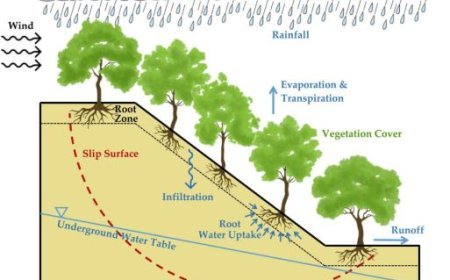
3. The earth's surface has a lot of elevation because different geomorphic processes happen at different speeds. The rocks in the earth's crust have different lithologies and structures, which means they fight gradational processes in different ways. Not only does regional geomorphic variability show differences in the landscape, but so do differences in the rocks' shapes and compositions. Changes in temperature, wetness, altitude, exposure, topography, and the amount and type of vegetation cover can have a big effect on the severity of certain processes in a certain area. Between a valley floor and a mountain, a northern and a southern exposure, and bare ground and ground with a lot of plants, the microclimate can be very different. The rates of all four processes—weathering, mass loss, erosion, and deposition—change significantly within very small ranges when local conditioning factors are taken into account.
4. Different geomorphic processes leave their own unique marks on landforms, and each process creates a unique set of landforms.
The word "process" refers to all the different physical and chemical changes that happen on the earth's surface. Exogenetic processes, which come from external forces like weathering, maswasting, and erosion, tend to wear down areas more quickly than endogenetic processes, which originate from forces inside the earth's crust like diastrophism and volcanism. Without these processes, the earth's surface would eventually become mostly flat. In the same way that plants and animals have unique traits that depend on the geomorphic process that formed them, landforms share similar traits. Understanding the role of processes in the development of landforms not only helps us understand how different landforms form, but it also brings attention to the genetic connections between groups of landforms. Landforms don't just happen to be connected to each other; in fact, some forms are more likely to be found near each other. So, the idea of different types of ground becomes basic to geomorphologists. There are a number of systems that make up most landscapes. A group of geomorphic processes and forces that work together in a certain climate is called a morphogenetic system.
5. Different forces that erode the earth's surface change it, resulting in a distinct hierarchy of landforms. Depending on what stage of growth they are in, the land forms have different traits. It was W. M. Davis who pushed this idea the most, and it was from this idea that he came up with the idea of the geomorphic cycle, which has stages of youth, adulthood, and old age that lead to a flat surface called peneplain. When you use the term "geomorphic cycle," it means that things change in a planned and logical way. But that doesn't mean that just because the topography of one area is called "young," "mature," or "old," the topography of another area in the same stage of development has exactly the same features. When geology, structure, and temperature change, landform features can be very different, even if the geomorphic processes have been at work for about the same amount of time. Because a lot of the earth's crust is unstable and can rise and fall at different rates, partial cycles are more likely to happen than full ones.
6. Geomorphic development is more often complicated than simple. Most of the details of the land's shape have likely been formed during this cycle of erosion, but there may still be remains of features formed during earlier cycles. Most of the time, we can tell which cycle is dominant. Horberg put the landscapes into five main groups in 1952: (1) simple, (2) complex, (3) monocyclic, (4) multicyclic, and (5) buried.
A simple landscape is one that is the result of a single significant geomorphic process. A complex landscape, on the other hand, is one where more than one major geomorphic process has shaped the landforms. Landscapes that are monocyclic have only experienced one cycle of erosion. Multicyclic landscapes have experienced more than one cycle of erosion. Weathering has repeatedly worn down a large portion of the earth's surface. Geological landscapes that were made in the past, buried under a cover mass of igneous or sedimentary rock, and then revealed again by removing the cover are called exhumed or resurrected landscapes. The rocks that are being dug up now could be from as far back as the Precambrian period or as recent as the Pleistocene.
7. The earth's surface is mostly no more than Pleistocene old, and not much of it is older than the Tertiary. Most of the features of the landform we see today probably don't come from before the Pleistocene, and not much of it was surface landform before the Tertiary. Most likely, the Himalayas were bent for the first time in the Cretaceous period and then again in the Eocene and Miocene. However, they didn't reach their current height until the Pleistocene, and most of the features of their landscape were formed at that time or later.
8. You can't fully understand how the countryside looks now without fully understanding how the changes in geology and climate during the Pleistocene affected it in many ways.
The Pleistocene has had a big impact on the landscape we see today. Glaciation had direct effects on many million square miles—maybe even ten million square miles. But its effects extended far beyond the areas where ice was actually present. Because glacial outwash and wind-blown objects from glaciers reached places where glaciers were not present, the effects of the climate were most likely felt all over the world. In areas with middle latitudes, the weather changes were very bad. There is strong proof that many places that are dry or mostly dry now had wet temperatures during the glacial periods. Even though glaciation was likely the most important event of the Pleistocene, we shouldn't forget that diastrophism, which began in the Pliocene and continued into the Pleistocene and even into the Recent, was still happening in many places. Pleistocene diastrophism has had a huge impact on the scenery we see today, especially around the Pacific Ocean.
9. To fully understand how important the different geomorphic processes are, you need to know something about the temperature of the whole world. Changes in the climate can have an indirect or direct effect on the way geomorphic processes work. Most of the indirect effects have to do with how climate changes the amount, type, and spread of vegetation growth. What kinds of rain and snow fall, how hard they fall, how they affect each other, and the daily temperature range, including whether and how often the temperature drops below, are direct factors. There are, however, other climate factors that have less obvious effects. These include the length of time the ground remains frozen, the frequency and intensity of rainstorms, the seasons with the most rain, the quantity of freeze and thaw days, the variations in climate between slopes that face the sun and those that don't, and the variations in climate between the windward and leeward sides of landforms where moisture-carrying winds cross.
10. Even though geomorphology is mostly about the landscapes of today, it is most useful when it looks back in time. In geomorphology, the main focus is on how the landscape we see today came to be. However, most landscapes have features that were there in earlier geological eras or epochs. This means that a geomorphologist has to look at things from a historical point of view in order to correctly understand the geomorphic past of a place. Paleogeomorphology is the study of past landscapes and how they were formed. It includes finding old weathering surfaces.
What's Your Reaction?


