PREDICTION OF TSUNAMI
Geologists analyze faults and past events to improve tsunami warnings, aiming to save lives.
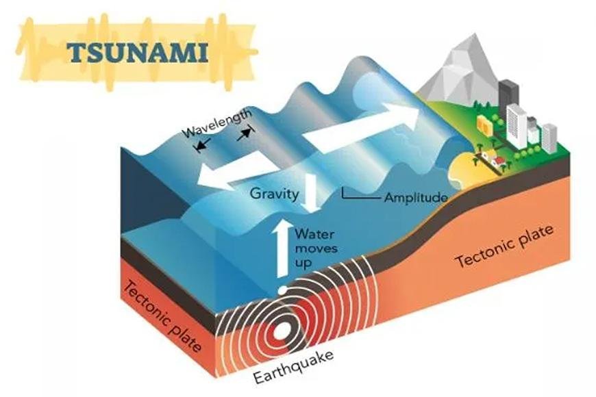
PREDICTION OF TSUNAMI
- Scientists are always looking for novel techniques to anticipate tsunami behavior.
- However, given existing technology, most tsunami data arrives after the harm has already happened.
- Geologists measure a variety of elements in a post-tsunami survey.
- Scientists are especially interested in the inundation and run-up characteristics that occur when the waves hit land.
- The maximum horizontal distance reached inland is referred to as inundation.
- The term "run-up" refers to the highest vertical distance the waves rose above sea level.
- Inundation and run-up are sometimes established by measuring the distance between dead vegetation, dispersed debris, and eyewitness descriptions of the occurrence.
- Scientists have made significant progress in detecting and forecasting the ongoing tsunami threat.
- The Pacific Tsunami Warning Center (PTWC) is one center that is constantly monitoring seismic events and changes in tide levels.
- The center is located in Ewa Beach, Hawaii, and it serves the Hawaiian Islands and adjacent US territories by collaborating with other regional centers.
- The West Coast and Alaska Tsunami Warning Center (ATWC), located in Palmer, Alaska, serves the Aleutian Islands, as well as British Columbia, Washington State, Oregon, and California.
- This site is especially significant because underwater earthquakes in this region have caused waves to travel across the Pacific Ocean before impacting elsewhere.
- Open-ocean buoys and coastal tide gauges provide information about tsunamis to local stations.
- Seismograph stations record earthquake activity, whereas tide stations measure minute changes in sea level.
- A tsunami warning is issued when a center detects an earthquake with a magnitude of 7.5 or greater.
- The data from tidal gauge stations is then constantly monitored, and civil defense authorities are alerted.
- A tsunami warning is sent to all possibly impacted locations if a hazardous wave passes through and sets off the gauge stations. Evacuation protocols are then undertaken in these regions.
Deep-Ocean Assessment and Reporting of Tsunamis (DART) employs novel pressure recorders installed on the ocean floor. - These recorders detect small changes in the underlying water pressure.
- The DART system is capable of detecting tsunamis as little as a centimeter above sea level.
- NASA is also extensively involved in the effort to forecast devastating tsunamis.
- NASA's Jet Propulsion Laboratory successfully showed pieces of a prototype tsunami prediction system in 2010.
- The technology correctly anticipated the magnitude of the tsunami following the February 27, 2010, Chilean earthquake using real-time data from the agency's Global Differential GPS (GDGPS) network.
- In the future, such a technology might provide more accurate prior warning of impending waves.
- The warning systems performed perfectly during the 2011 Japan tsunami. Rather, it was the event's unexpected scale that proved fatal.
- That brings us to the most serious issue with tsunamis: they can't be halted once they're in motion.
- Scientists and government organizations can only commit resources to anticipating tsunamis and developing effective measures to safeguard coastal regions from their wrath.
What's Your Reaction?


