ELECTROMAGNETIC SPECTRUM IN REMOTE SENSING
Learn about the electromagnetic spectrum's role in remote sensing, including its applications and importance in understanding Earth's surface.
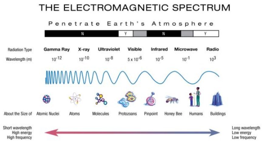
Electromagnetic Spectrum in Remote Sensing
- It works because of how electromagnetic radiation (EMR) reacts with the surface of the Earth.
- You need to know about the electromagnetic spectrum, which is a range of electromagnetic waves, in order to pick the right tools and understand what the data means in remote sensing.
1. The Electromagnetic Spectrum
- There are many groups of energy in the electromagnetic spectrum, based on size and frequency. The following are some critical components of the spectrum that are relevant to remote sensing:
- Visible Range (0.4–0.7 µm): This range has colors that the human eye can see, from violet to red. It helps people figure out what they see, learn about plants, and find bodies of water.
- Infrared (NIR) Range (0.7–1.3 µm): NIR light can pass through plant covers and can help you tell if plants are healthy, have enough biomass, or are having trouble getting enough water.
- SWIR Region (1.3–3 µm): This range can tell you how much water is in the soil, which lets you map the amount of wetness and find out what minerals are there.
- Within the 3–15 µm band, everything gives off thermal infrared light. This kind of radiation can tell you about the surface temperature of an item, help you find heat sources, and show you strange thermal patterns.
- Waves in the microwave range (1 mm to 1 m) can pass through clouds and plants. This makes them useful for taking pictures in all kinds of weather, keeping track of how wet the ground is, and finding out how much rain fell.
2. Interaction of EMR with Earth's Surface
- The data that remote sensing tools collect is based on how EMR reacts with the surface of the Earth.
Here are some important trades:
- Electromagnetic energy (EMR) waves hit the surface and tell us about its color, shape, and make-up.
- The surface takes in EMR, which teaches us about the structure and make-up of the stuff inside.
- Transmission: EMR can pass through the surface, which provides the ability to do some study below ground, such as mapping the level of moisture in the soil using microwaves.
- When the surface is hot, it gives off electromagnetic radiation (EMR), which tells us about how it heats up.
3. Spectral Signatures
- Spectrum signatures show how things mirror, receive, and send out electromagnetic waves.
- Everything is different and has its own spectrum identity. These fingerprints are very important for finding things in remote sensing pictures and putting them into groups.
- Vegetation: Chlorophyll in plants takes in a lot of visible light and sends back a lot of light in the near infrared range.
- Water: The darkening of images is a result of the significant blocking of visible and near-infrared light by water.
- Soil: The spectrum fingerprints of soil are affected by its chemical make-up, level of wetness, and amount of organic matter.
- Buildings and smooth streets always reflect light well in cities, but water and plants show different signs.
4. Picking a Sensor
- When you are doing remote sensing, the thing you are studying, the data you need, and the weather at the time all affect which monitor you choose.
- Sensors that are multispectral collect data in several bands, including the visible, near-infrared, and far-infrared ranges. This lets them show the unique spectral fingerprints of different materials.
- With hyperspectral devices, you can get information in hundreds of narrow bands. This gives you detailed spectral data that you can use to correctly identify and study materials.
- The microwave range is where microwave devices work. They can take shots in any weather and tell you about the ground below.
5. Electrical Spectrum Uses in Remote Sensing
- Using the electromagnetic spectrum in a lot of different ways is possible because it has a lot of different spectral traits.
- Land Cover Mapping: This is the process of finding and putting together the different types of land cover, such as cities, farms, and woods.
- When you monitor the environment, you keep an eye on changes in things like natural disasters, the health of plants, water sources, and the quality of the air.
- As part of managing resources, people look at the land's features, make maps of mineral layers, watch how food grows, and take care of water sources.
- A big part of urban planning is keeping an eye on urban sprawl, figuring out where good growth can happen, and measuring the growth of infrastructure.
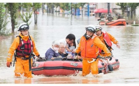
- For quick and effective response to disasters like wildfires, floods, earthquakes, and more, disaster management is the process of finding them.
What's Your Reaction?


