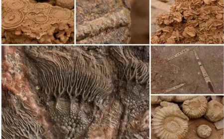
LITHOSTRATIGRAPHY
Learn about lithostratigraphy, the study of rock layers, and its importance in understanding Earth's geological past. Explore the principles and applications of this vital field.
- Lithostratigraphy
- Lithostratigraphy is a scientific practice that examines the physical and mineralogical properties of rock layers, often known as strata.
- This subject pertains to the categorisation and association of rock units.
- Objective: To analyse the arrangement, makeup, and chronological order of rock formations, therefore facilitating the reconstruction of previous geological settings and better comprehension of the geological history of a certain region.
- Fundamental Principles
- Lithologic units refer to rock strata that are characterised by their specific physical and mineralogical features.
- Facies refer to unique rock features that indicate the circumstances under which rocks were formed and may be used to deduce previous environments.
- Correlation refers to the procedure of establishing an association between rock strata from various geographical areas by analysing their lithological characteristics.
- Units Based on Lithostratigraphy
Literature Description
- Texture: particle size (e.g., sediment, granulated rock).
- Composition: found mineral and rock kinds.
- Colouration: Effects of mineral composition and weathering.
There exist several categories of lithostratigraphic units:
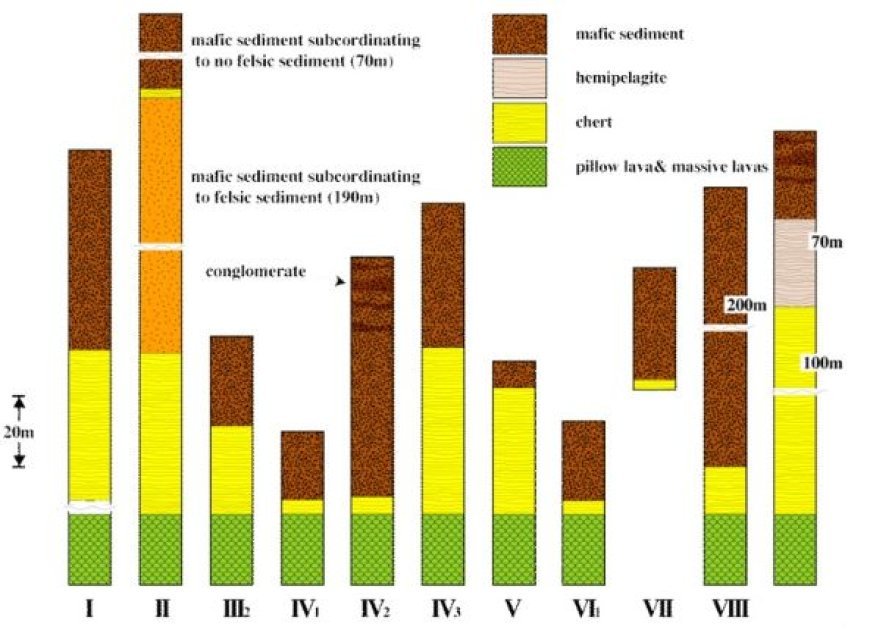
- Formation in lithostratigraphy refers to a basic unit that is identifiable and can be mapped, characterised by consistent lithologic features.
- A member refers to a subdivision of a formation, which is a smaller and unique layer or group of layers within that formation.
- Bed: the most basic lithostratigraphic unit; a single layer exhibiting consistent properties.
- A group refers to a set of two or more formations that have similar lithological features and are grouped together for the purpose of statistical correlation.
4. Identification of Lithostratigraphic Classification
1. Lexical Classification
- Clastic rocks are deposits of sediment particles such as sandstone and shale.
- Chemical rocks are formed by precipitation from a solution, such as limestone or evaporites.
- Igneous rocks are formed from geologically solidified magma, such as basalt or granite.
2. Investigation of Facies
- Depositional Environment: Analysing facies to recreate historical ecosystems like rivers, lakes, or marine habitats.
- Facies change refers to the study of transitions between distinct facies in order to gain insight into geological history and processes.
5. Lithostratigraphic Correlation
Main ideas
- The principle of lithologic continuity states that units with comparable lithological properties may be tracked over vast regions.
- Principle of Superposition: In undisturbed sequences, the older layers are positioned under the younger layers.
- Principle of Lateral Continuity: Layers initially expand horizontally in all directions until they become thinner or come into contact with a physical obstruction.
- Methods: Field Mapping: The act of seeing and recording rock units and their interrelated structures in the field.
- Geophysical surveys include techniques such as seismic reflection to cartograph subsurface rock units.
- The process of drilling and core sampling involves the extraction of rock samples from the subsurface in order to examine lithological characteristics.
6. Case Studies
- Sedimentary basins: analysing sedimentary strata within basins to get insights into the geological history of local areas.
- Analysis of volcanic deposits in volcanic regions to track volcanic activity and its effects on the adjacent rock strata.
- Tectonic settings refer to the study of rock units in regions of tectonic activity in order to get valuable insights on deformation and structural geology.
7. Practical Uses
- Resource exploration is the identification and mapping of rock units in order to find and extract natural resources such as oil, gas, coal, and minerals.
- The assessment of rock units in environmental studies is conducted to get insights into groundwater movement, pollution, and land use planning.
- Geological mapping involves the creation of comprehensive geological maps for academic, engineering, and planning objectives.
What's Your Reaction?


